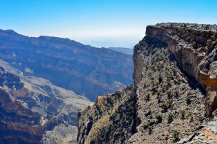
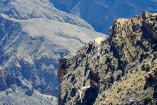
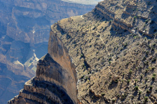
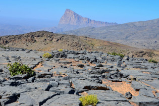
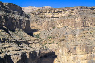
Der „Grand Canyon des Oman“ ist in Wahrheit die bis zu 1.000m tiefe Schlucht des Wadi Nakhar. Die grandiosesten Ausblicke in die imposante Schneise bietet ein Hochplateau auf 2.000 Metern Höhe.
Die Wadi Nakhar Schlucht wird auch als der Grand Canyon des Oman bezeichnet und ist tatsächlich nahezu ebenso eindrucksvoll wie sein berühmter Namens-Vetter, der Grand Canyon in den USA. Die spektakuläre Schlucht steht auf unserer Liste der Top 10 Sehenswürdigkeiten im Oman und ist von Nizwa aus über Al-Hamra zu erreichen. Von hier zweigt eine Straße Richtung Ghul ab.
Anzeige
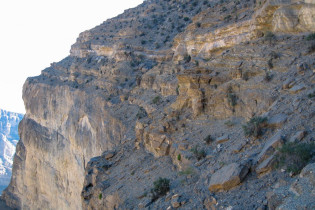
In Ghul sollte man sich Zeit für einen kurzen Stopp nehmen und einen Blick auf die alte, verlassene Siedlung werfen, die wie ein Adlerhorst am Felsen klebt. Sobald man Ghul passiert hat geht die Straße weiter auf den Jebel Shams – den höchsten Berg des Oman.
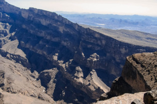
Aussichtspunkt mit Blick auf den „Grand Canyon des Oman“
Den Gipfel des Jebel Shams (3.009m Seehöhe) kann man nicht besteigen. Dort steht eine Radarstation des Militärs, die das Gebiet zum militärischen Sperrgebiet macht. Man kann zwar bis zu den Toren des Sperrgebiets fahren, es lohnt sich aber nicht wirklich.
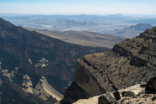
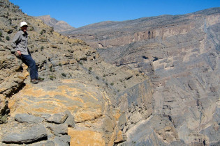
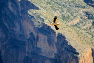
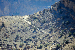
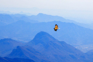
Die spektakulärsten Ausblicke in den sogenannten Grand Canyon des Oman hat man von einem in ca. 2.000m Höhe liegenden Hochplateau. Vom Rand des Hochplateaus hat man ein fantastisches Panorama in die 1.000m tiefe Wadi Nakhar Schlucht. Mit etwas Glück zieht gerade ein Geier seine Kreise in den Lüften.
Damit auch nicht Schwindelfreie diesen beeindruckenden Ausblick genießen können, gibt es bei einem Aussichtspunkt Sicherheitsabsperrungen am Rande des Steilhangs. Von hier hat man eine grandiosen Rundblick auf die umliegende Berglandschaft und auch der Gipfel des Djebel Shams ist mit seiner Radarstation leicht zu erkennen.
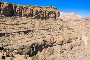
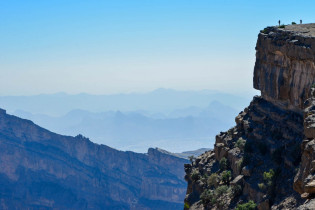
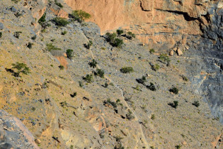
Fährt man weiter bis zum Ende der Piste – einer kleinen Häuseransammlung – kann man von dort eine abenteuerliche Wanderung in den Canyon starten. Der Weg durch das Wadi Nakhar – ein ehemaliger Eselspfad – führt ca. 4 km direkt an der Westflanke des Grand Canyon, stellenweise direkt an der abfallenden Kante entlang. Man kann sich an den fantastischen Ausblicken gar nicht satt sehen!
Achtung: Der Weg ist nichts für Halbschuhtouristen. Gute Bergschuhe, Trittsicherheit und genügend Trinkwasser sind unbedingte Voraussetzungen um diesen Pfad zu begehen. Hin- und zurück benötigt man ca. 3-4 Stunden.
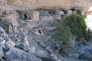
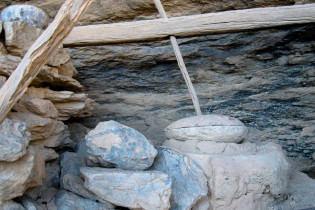
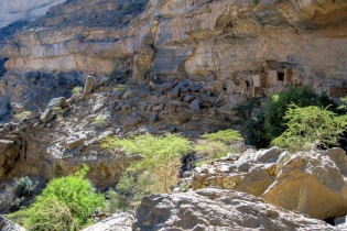
Am Ende des Weges kommt man in eine mittlerweile verfallene Siedlung, die heute als Freilichtmuseum dient. In dem Dorf wohnten ca. 15 Familien. Es war gut gegen Feinde geschützt und mit Wasser versorgt.
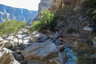
Bevor man wieder den gleichen Weg zurück nimmt, kann man sich unter gewaltige Felsüberhänge in den kühlen Schatten setzen und sich von den Strapazen des Weges erholen.
Das vom Berg herabfließende Wasser bildet einen kleinen See und die Ruinen der Häuser und Reste der damaligen Terrassenfelder vermitteln einen guten Eindruck, wie das Leben hier früher einmal abgelaufen ist. Jeder der diesen Weg auf sich nimmt wird mit einem unvergesslichen Eindruck nach Hause kommen.