
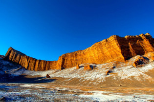
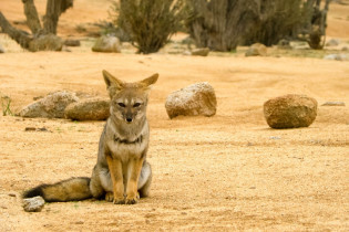
Die Atacama-Salzwüste im Norden Chiles reicht vom Pazifik bis zu den Anden und gilt als die trockenste Wüste der Welt. Durchquert werden kann die ebenso karge wie faszinierende Landschaft per Bus, per Auto – oder auf dem Lama.
Die Atacama-Salzwüste im Norden von Chile erstreckt sich vom Pazifischen Ozean bis zur Gebirgskette der Anden und gehört zu unseren Top 10 Sehenswürdigkeiten von Chile. Sie gilt als die trockenste Wüste der Welt, denn durchschnittlich regnet es hier ein- bis zweimal pro Jahrzehnt. An manchen Orten wurden sogar überhaupt noch nie Niederschläge gemessen, denn die Anden fangen jegliche Regenwolken ab.
Inhaltsverzeichnis
BILDER: Atacama-Salzwüste


Beste Reisezeit für die Atacama Wüste

Die Hauptreisezeit für die Atacama-Wüste ist Dezember bis Februar, also im südamerikanischen Sommer. Allerdings kann es zu dieser Zeit zu sintflutartigen Regenfällen kommen (ca. alle 5 bis 10 Jahre), die durch den Klimawandel immer häufiger vorkommen. Diese lassen zwar mit etwas Glück die gesamte Wüste erblühen, können aber auch viele Wege unpassierbar machen. Auch im Oktober/November oder März/April ist es schön warm und das Wetter eignet sich vor allem für Wanderungen.
Im Juli und August ist es eiskalt in der Atacama. Temperaturen um -20 Grad Celsius sind hier keine Seltenheit und an den zugefrorenen Lagunen sind dann auch keine Flamingos zu finden. Der Sternenhimmel ist in der klirrenden Kälte dafür noch gigantischer als sonst.
Unterwegs in der Atacama-Wüste
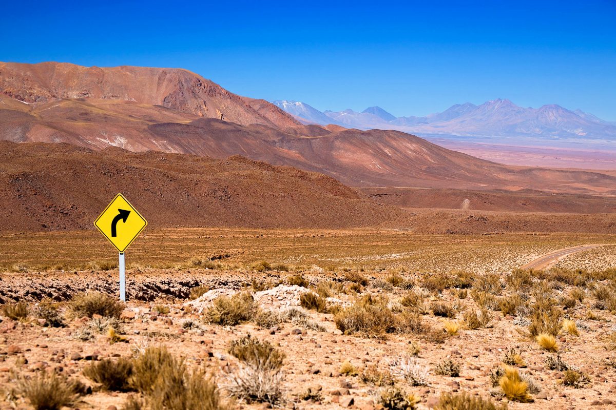
Besucher können die Atacama-Salzwüste entweder mit einer Reisegruppe in einem Reisebus oder auf eigene Faust mit einem Mietauto durchqueren. Der Vorteil des Mietautos ist, dass man jederzeit stehen bleiben und das faszinierende Panorama genießen kann. Der große Nachteil ist allerdings, dass man im Fall einer Panne wohl sehr lange auf den Abschleppdienst wartet. Besondere Naturbegeisterte können einen Trip durch die Wüste auf dem Lama wagen.
Die trostlos karge aber ebenso erstaunliche Landschaft der Atacama-Wüste wird oft als mondähnlich beschrieben und wurde deshalb auch schon für den Prototyp-Test des künftigen Mond-Rover gewählt. Die, wie man sich vorstellen kann, sehr dünn besiedelte Wüste ist reich an Bodenschätzen, deren Abbau eine Wirtschaftsgrundlage Chiles bildet.
Die trockene Luft über der Wüste eignet sich hervorragend zur Himmelsbeobachtung. Einige der größten Sternwarten der Welt sind hier auch für Hobbyastronomen zugänglich. Hier steht zum Beispiel die La Silla Sternwarte der ESO, deren Teleskopen wir einige bedeutende astronomische Entdeckungen zu verdanken haben.
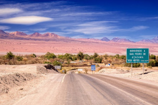
San Pedro de Atacama
Ausgangsbasis und Abschluss vieler Atacama-Reisen ist die kleine Oase San Pedro de Atacama. Die Stadt kann mit dem Bus oder dem Auto gut über die asphaltierte Straße zwischen der Stadt Calama und dem Nachbarstaat Argentinien erreicht werden. Sie liegt am nördlichen Ende des Salzsees Salar de Atacama, 2.440 Meter über dem Meer und wird von insgesamt etwa 4.000 Menschen bewohnt.
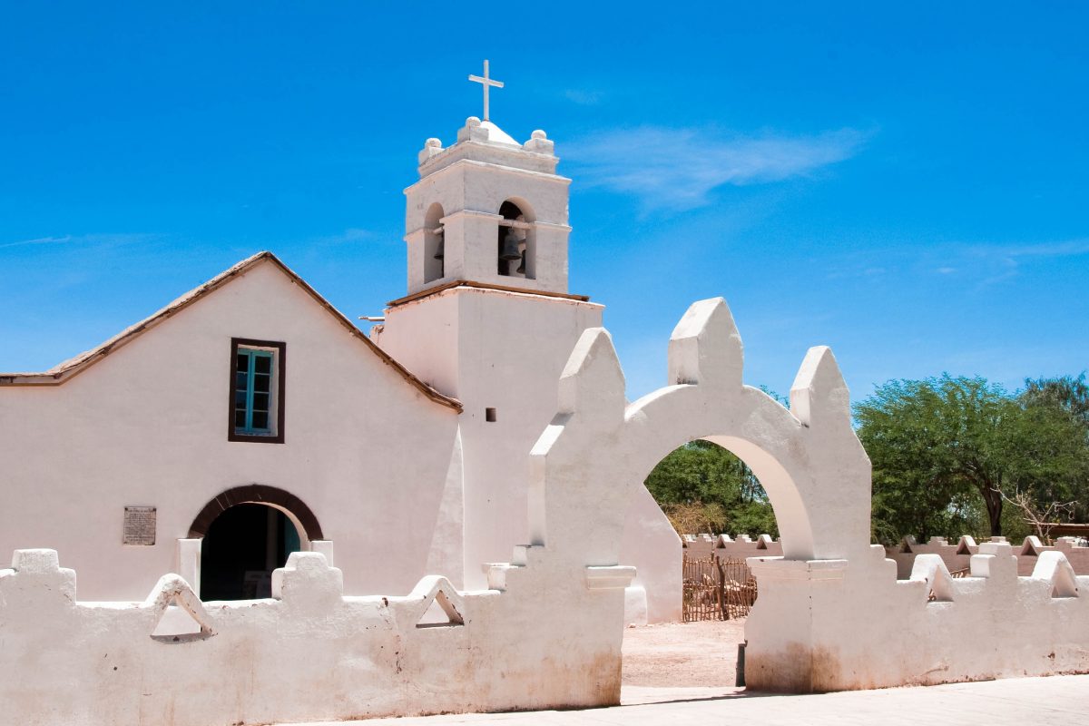
Die Gegend um die Stadt wird vom Wasser des Flusses Rio San Pedro gespeist, weshalb man hier auch einiges Grün findet. Im Zentrum von San Pedro de Atacama, das man leicht zu Fuß durchlaufen kann, steht eine hübsche Kirche, die zu den ältesten von ganz Chile zählt und deren Dach aus Kaktusstämmen erbaut wurde. Für Interessierte gibt es außerdem ein archäologisches Museum.
In der Stadt findet man auch eine Auswahl an netten Hotels und Restaurants, in denen man sich von dem anstrengenden Trip durch die Wüste erholen kann.
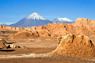
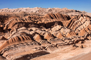
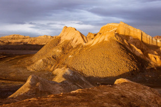
Valle de la Luna

Sehenswert ist auf jeden Fall das Valle da la Luna etwa 15 Kilometer außerhalb von San Pedro. In dem staubtrockenen Mondtal ist das wunderschöne Naturschauspiel des Sonnenauf- und -untergangs über der bizarren Landschaft ein einzigartiges Erlebnis. Die außerirdisch anmutenden Gesteinsformationen verändern sich je weiter man in das Tal hinein wandert und bieten atemberaubende Fotomotive.
Puritama Tal
Durch den Puritama River gibt es hier Wasser in der Wüste und das Puritama Tal kann mit üppigem Grün zwischen roten Felswänden aufwarten. Am Ende des Tals befinden sich sogar einige heiße Quellen – mitten in der trockensten Wüste der Welt kann man also erstaunlicherweise ein Bad nehmen.
Chuquicamata – weltgrößte Kupfermine
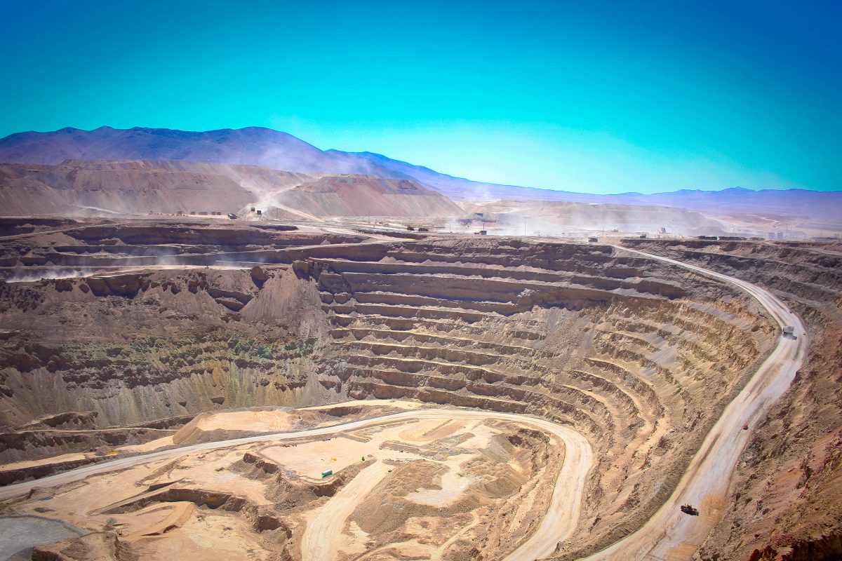
Die Mine Chuquicamata etwa 15 Kilometer von der Stadt Calama entfernt ist die größte Kupfermine der Welt und stellt einen wichtigen Wirtschaftszweig für Chile dar.
Geschichte des Kupfer-Abbaus in Chuquicamata
Die reichen Kupfervorkommen der Mine wurden nach dem Salpeterkrieg (1879 – 1884), den Chile mit finanzieller Hilfe von Großbritannien gegen Bolivien und Peru führte, entdeckt. Vor dem Krieg gehörten die Stadt Calama und Chuquicamata zu Bolivien. 1915, einige Jahre nach dem Krieg, wurde in der Chuquicamata-Mine mit dem Abbau von Kupfer begonnen.
Im Jahr 1912, drei Jahre vor Beginn des Abbaus, wurde die Mine von der amerikanischen Firma Guggenheim Bros. übernommen und von dieser 1923 an die Anaconda Copper Mining Company, ebenfalls eine amerikanische Firma, übergeben. Erst 1971 ging die Mine in den Besitz des chilenischen Staatsunternehmens Codelco (Corporacion Nacional des Cobre de Chile) über, und zwar durch die Verfassungsreform unter der Regierung von Salvador Allende.
Wirtschaftssegen und Umweltfluch
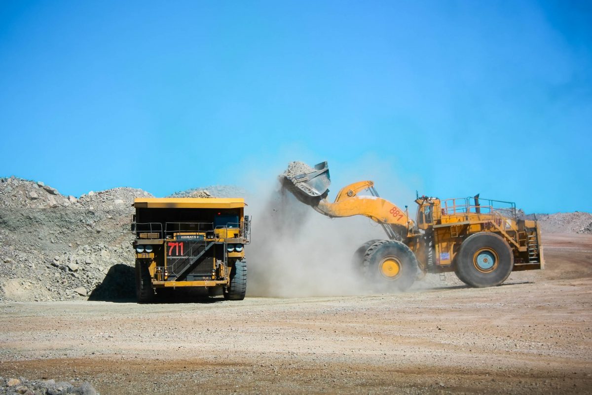
Täglich werden in Chuquicamata unglaubliche 180.000 Tonnen Gestein mit einem Kupfergehalt von 1,5% abgebaut. Daraus lassen sich ungefähr 2.500 Tonnen hochprozentiges Kupfer gewinnen.
Heute wird in der Mine nur Tagebau betrieben. Dieser ist ca. 4 Kilometer lang, 3 Kilometer breit und 850 Meter tief. Das gewonnene Kupfer wird mit der Bahn zuerst über Calama in den Hafen von Antofagasta gebracht, von wo aus es per Schiff hauptsächlich nach China transportiert wird. Da Chile über 40% des Weltvorkommens an Kupfer verfügt, verdankt es diesem einen großen Teil seines nationalen Einkommens.
In der Mine sind ca. 2.000 Arbeiter beschäftigt. Aufgrund des hohen Feinstaubgehalts kommt es allerdings oft zu Berufserkrankungen wie Staublungen, Asthma oder Krebs. Aufgrund dieser schweren Belastungen wurden die Bewohner von Chuquicamata, das früher einmal eine Kleinstadt war, im Jahr 2004 nach Calama umgesiedelt, wo ein eigenes Wohnviertel für sie errichtet wurde.
Ihre ehemaligen Häuser stehen heute noch, als würden sie morgen wieder bezogen werden. Die Anzahl der Touristen, die die Mine jährlich besuchen, dezimierte sich dadurch allerdings nicht.
Che Guevara bezeichnete die Mine von Chuquicamata einst als das Sinnbild der arbeitenden Klasse. Heute steht sie eher für Umweltverschmutzung (immer mehr Arsen und andere gefährliche Substanzen gelangen mit den Abwässern ins Umland), aber auch für Rohstoffreichtum und eine wirtschaftlich wertvolle Vielzahl an Touristen.
Besuch der Chuquicamata-Mine
Besuchern bietet die Chuquicamata ein einzigartiges Erlebnis im weltweit größten Kupfertagebau. Will man das gesamte Gelände besichtigen, muss man schon einen ganzen Tag für die Führung einplanen. Ausgestattet mit Schutzkleidung geht es dann zu den verschiedensten Aussichtsplattformen, deren gigantisches Panorama erst die wahren Ausmaße der riesigen Minen-Krater erkennen lässt.
Die Arbeiter können beim Abbau beobachtet werden, auch ein Zwischenstopp in der Wartungs- und Reparaturhalle der beinahe furchteinflößenden Monstermaschinen ist eingeplant. Das Programm wird durch aufschlussreiche Vorträge und anschauliche Präsentationen untermalt und ist nicht nur für Technik-Freaks absolut empfehlenswert!
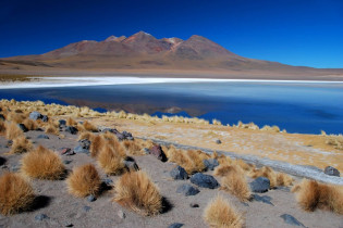
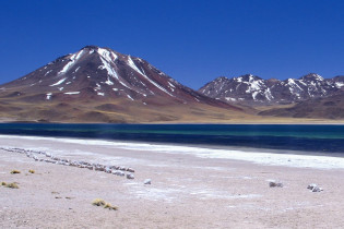
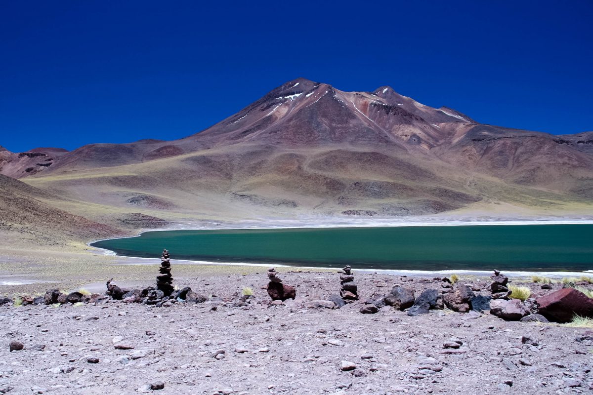
Laguna Chaxa
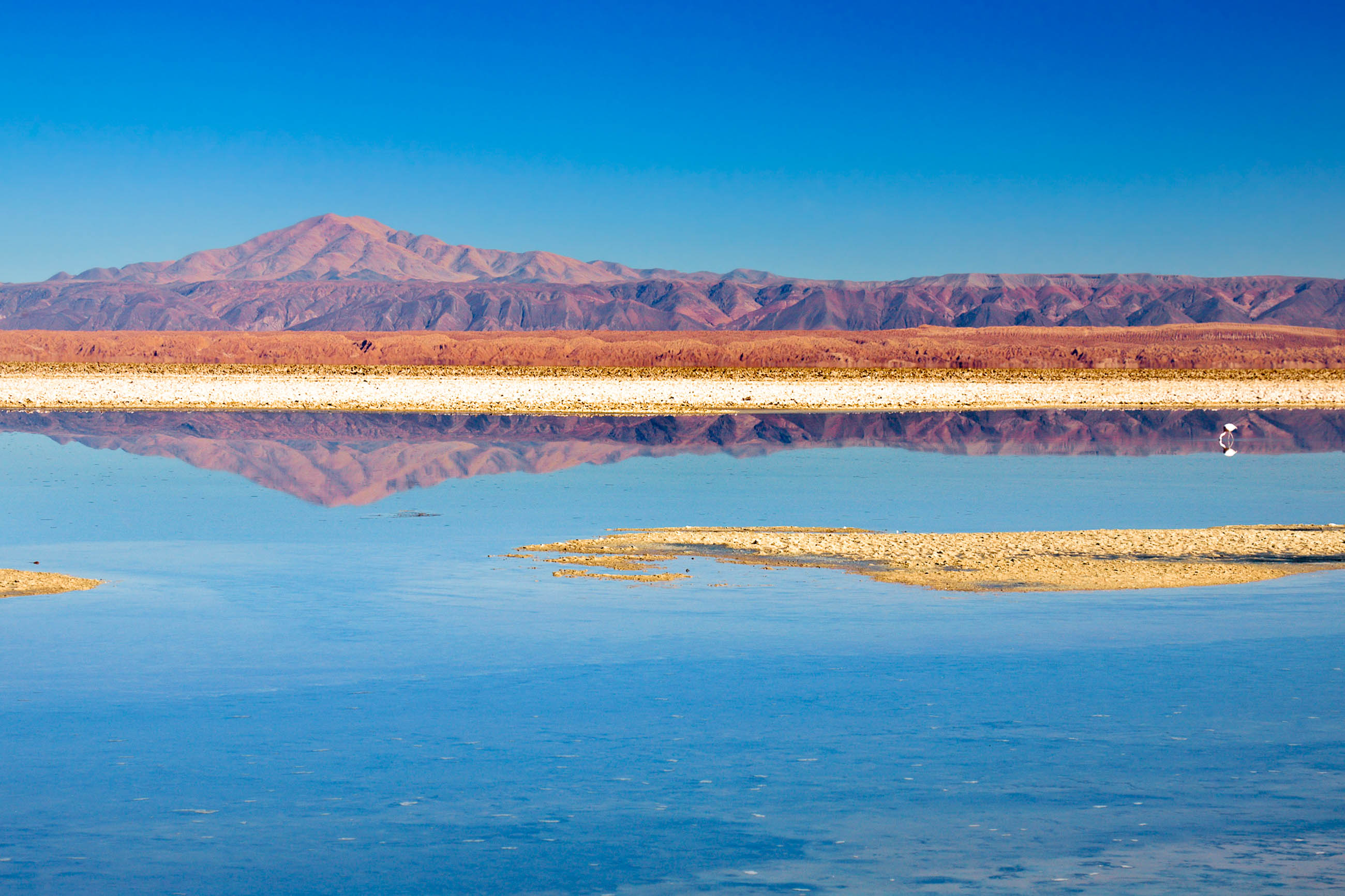
Die Lagune Chaxa liegt etwa 50 Kilometer von San Pedro de Atacama entfernt im Naturreservat Reserva Nacional Los Flamencos. Sie ist eines der so genannten „Wasseraugen“, die sich im Salar de Atacama, dem rund 3.000 Quadratkilometer großen Salzsee in der Atacama-Wüste, befinden.
Die ebenfalls salzige Lagune wird aus vielen unterirdischen Quellen gespeist. Gäbe es diese unterirdischen Wasseradern nicht, würde die Lagune schlichtweg austrocknen, denn auf Regen wartet man in der Atacama-Wüste meist vergeblich.
Dadurch, dass das unterirdische Wasser ständig Mineralien und Salze aus dem Vulkangestein löst, verdunstet das Wasser nicht, der Salz- und Mineraliengehalt steigen aber ständig an. Salz, Wasser und die Wüstentemperaturen formten die bizarre Landschaft der Laguna da Chaxa zu einem unwirklichen Meer aus blau schimmernden Pfützen und weiß glänzenden Salzkristallen. Die Straße, die zur Laguna de Chaxa führt, besteht auf den letzten Kilometern ausschließlich aus Salz.
Unzählige Flamingos an der Lagune Chaxa
Zum perfekten Fotomotiv tragen noch die farbenprächtigen Flamingos bei, die sich in diesen Umweltbedingungen wohlfühlen. Etwa 200 der lachsfarbenen Tiere tummeln sich um die salzigen Wasserlöcher. Die Chile-, Anden- und James-Flamingos ernähren sich hauptsächlich von Krill, kleinen garnelenartigen Wesen, die sie aus dem salzigen Wasser fischen.
Flamingos sind allerdings sehr scheu, wer sie also beobachten oder fotografieren möchte, sollte sich frühmorgens auf den Weg zur Lagune machen, um ein paar ungestörte Minuten mit den eleganten Vögeln verbringen zu können. Zu viele Touristen verscheuchen die Flamingos.
Ein befestigter Rundweg, der die Lagune in zwei Hälften teilt, führt in die Nähe der teils offenen, teils geschlossenen Salzblasen. Dazwischen kann man hin und wieder einen Blick auf eine der Eidechsen erhaschen, die sich zwischen den Salzplatten verstecken.
Vom Rundweg aus hat man auch einen idealen Blick auf die Uferwände unter Wasser, die aufgrund der Ablagerungen von Salzkristallen und Mineralien in allen Farben des Regenbogens schimmern.
In dieser Gegend gibt es auch einen Vulkan, den Lasarvulkan, dessen letzter Ausbruch im Jahr 1993 auf einem großen Panoramafoto festgehalten ist. Der Ausbruch dauerte damals 36 Stunden, wobei die Asche aufgrund des starken Westwindes sogar bis nach Brasilien gelangte.
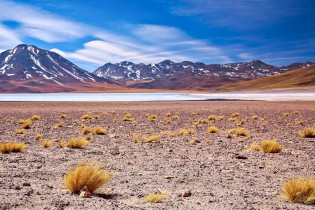
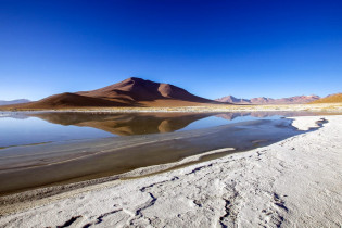
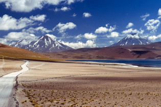
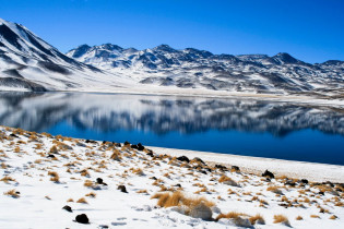
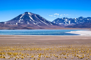
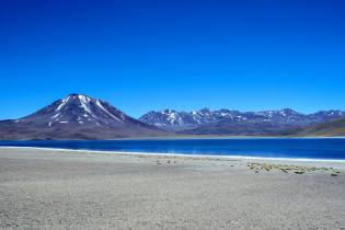
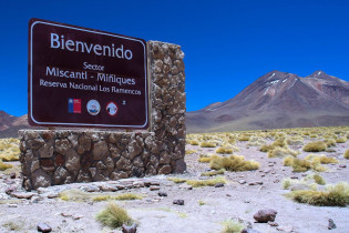
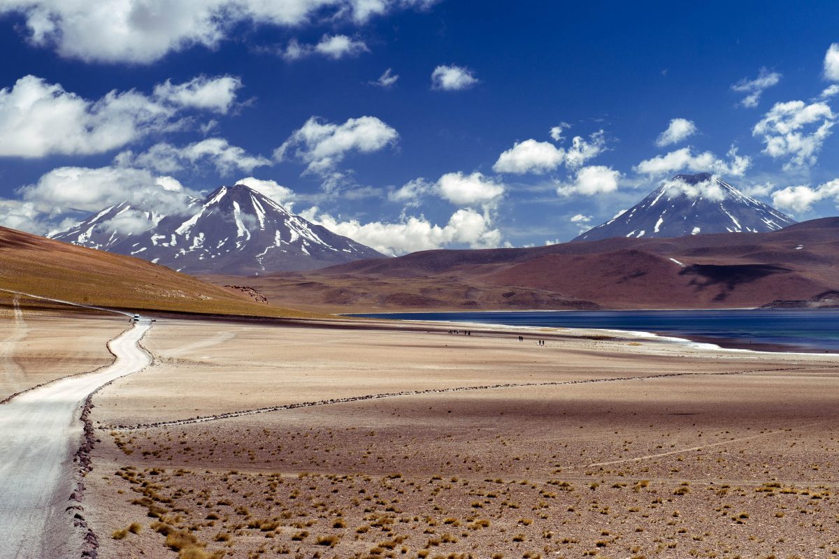
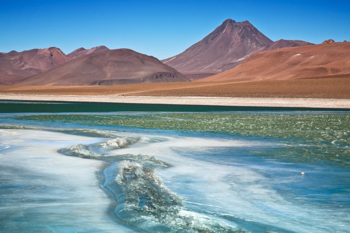
Laguna Miscanti und Miñiques
Die beiden malerischen Lagunen Miscanti und Miñiques liegen am Rande der Atacama-Salzwüste auf ca. 4.300 Höhenmetern. Sie werden majestätisch überragt von dem Berg Cerro Miscanti und dem Vulkan Miñiques, welcher die beiden Lagunen einst durch einen Lavastrom nach einem Ausbruch voneinander trennte.
BILDER: Lagunen Miscanti und Miñiques


Fotogalerie: Lagunen Miscanti und Miñiques
Anfahrt zu den Lagunen Miscanti und Miñiques
Eine Besichtigung der Lagunen mit ihrem unglaublichen Panorama ist ein Muss. Wer sie auf eigene Faust erkunden will, nimmt zuerst einen öffentlichen Bus, der dreimal pro Woche von San Pedro de Atacama spätabends in das ursprünglich gehaltene Atacamadorf Socaire fährt. Somit hat man auch einmal die Gelegenheit das einfache Leben in der Atacama-Wüste kennen zu lernen.
Wenn einem die Nutzung der öffentlichen Verkehrsmittel und die Nächtigung in Socaire zu mühsam ist, kann man auch ein Auto mieten, vorausgesetzt man bringt einen internationalen Führerschein mit. Wesentlich einfacher zu erreichen sind die beiden Lagunen über eine leider etwas kostspieligere geführte Tour.
Weiterreise von Socaire zu den Lagunen
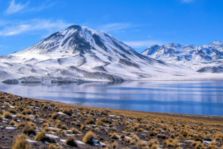
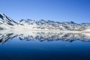
Von Socaire fährt man entweder mit dem Mietauto oder einem Taxi (man kann Fahrer anheuern, die einen zu den Lagunen bringen) auf über 4.000 Meter Höhe, wo man die beeindruckenden tiefblauen Lagunen, an deren Ufer ein weißer Salzstreifen sichtbar ist, bestaunen kann.
Die Berge in der Nähe der beiden Lagunen erreichen ca. 6.000 Höhenmeter. Es gibt die Möglichkeit, in San Pedro de Atacama Touren zu buchen, um sie zu besteigen. Der unbeschreibliche Ausblick von seinem Gipfel entschädigt dabei für alle körperlichen Strapazen!
Gleich neben den Lagunen befindet sich das Refugio der Organisation Lican Huasi, die ihren Sitz in San Pedro hat. Diese Herbergen sind überall in den Andendörfern verteilt, auch in Socaire findet man eine solche.
Schauspiel von Sonne und Sternen

Ein Naturschauspiel, das man auf keinen Fall verpassen sollte, ist das wahrhaft spektakuläre Schauspiel des Sonnenauf- und -untergangs, wenn sich die gesamte Umgebung und der Vulkan tiefrot färben. Es empfiehlt sich auch auf jeden Fall, nach dem Sonnenuntergang einen Blick in den Himmel zu werfen, denn die Atacama-Wüste ist für den weltweit klarsten Sternenhimmel bekannt.
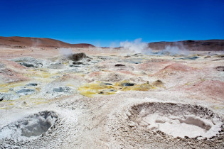
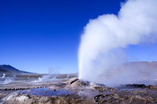
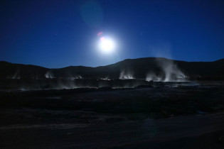
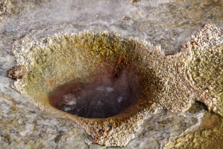
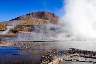
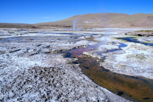
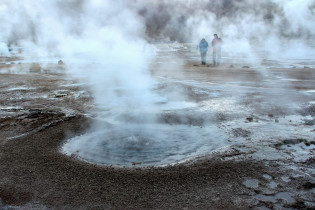
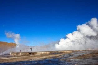
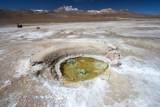
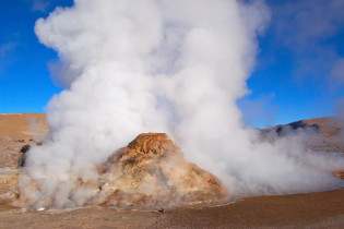
Geysirfeld El Tatio

Das Geysirfeld El Tatio im Norden Chiles ist das höchstgelegene Geysirfeld der Welt (ca. 4.300 Meter). Es befindet sich etwa 100 Kilometer nördlich von San Pedro de Atacama. Die Geysire, die auf der vereisten Hochebene in einem Krater des Vulkans El Tatio liegen, stoßen riesige Dampfschwaden aus, die bis zu 50 Meter weit in die Luft geschleudert werden. Die fauchend rauchende Wunderwelt gehört zu unseren Top 10 Sehenswürdigkeiten von Chile.
BILDER: Geysirfeld El Tatio

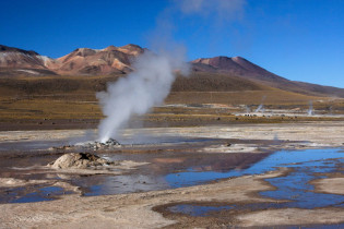
Fotogalerie: Geysirfeld El Tatio
Besuch von El Tatio: am besten am frühen Morgen
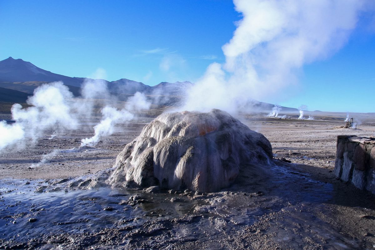
Das grandiose Spektakel der wasserspeienden Erdlöcher ist nichts für Langschläfer. Die Aktivität der Geysire sinkt nämlich stark, sobald die Sonne auftaucht. In der Nacht werden zwischen den Geysiren Temperaturen um die minus 10°C gemessen.
Wenn die Sonne über die Gipfel der Berge empor steigt, spiegelt sie sich in beeindruckender Weise in den Dampfwolken der Geysire, aber nur solange die Luft noch kalt ist. Danach verschwindet der Dampf und in den Geysiren bleibt nur ein leichtes Blubbern zurück. Es empfiehlt sich daher, um 4:30 morgens von San Pedro de Atacama aufzubrechen, denn die Fahrt zu den Geysiren, meist auf Schotterpisten, dauert ca. 2 Stunden.
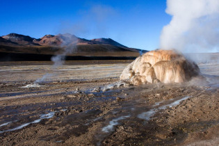
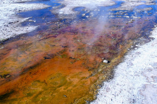
Farbenspiel unter Dampfschwaden

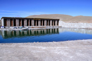
Nach dem spektakulären Sonnenaufgang kommen die farbenprächtigen Ablagerungen der Geysire zum Vorschein. Außerdem kann man sich dann auch mit einem Bad in den warmen Quellen aufwärmen.
Wer sich im Geysirfeld von El Tatio bewegt, sollte aber Vorsicht walten lassen, denn es wurden hier noch keine Absperrungen eingerichtet und man tut gut daran, einen sicheren Abstand von den Wasserfontänen einzuhalten.
Im Geysirfeld findet man auch einige verrostete Maschinenteile, mit denen in der Vergangenheit bereits zweimal versucht wurde, Energie aus den Geysiren zu ziehen. Beide Male, sowohl im Jahr 1920 als auch 1967, blieben diese Versuche aber ohne Erfolg.
Achtung: Höhenkrankheit vorbeugen!
Bevor man sich auf den Weg zu den Lagunen und den Geysiren macht, sollte man sich unbedingt einige Tage lang an die höheren Lagen gewöhnen, denn sonst kann es zur Höhenkrankheit kommen, die sich durch Kopfschmerzen, Übelkeit und einem allgemeinen Unwohlsein beginnt. Ignoriert man die Symptome, werden diese mit der Zeit immer stärker und können in einem lebensgefährlichen Zustand enden.
Um das Auftreten dieser Krankheit zu verhindern, sollte man möglichst langsam aufsteigen (300 bis 500 Höhenmeter pro Tag; hat man vor, auf über 5.000 Höhenmeter zu steigen, empfiehlt es sich, zuvor eine Woche auf ca. 3.000 Höhenmetern zu verbringen). So hat der Körper Zeit, sich an die veränderten Bedingungen zu gewöhnen.
Weiterführende Links:


